California Ice
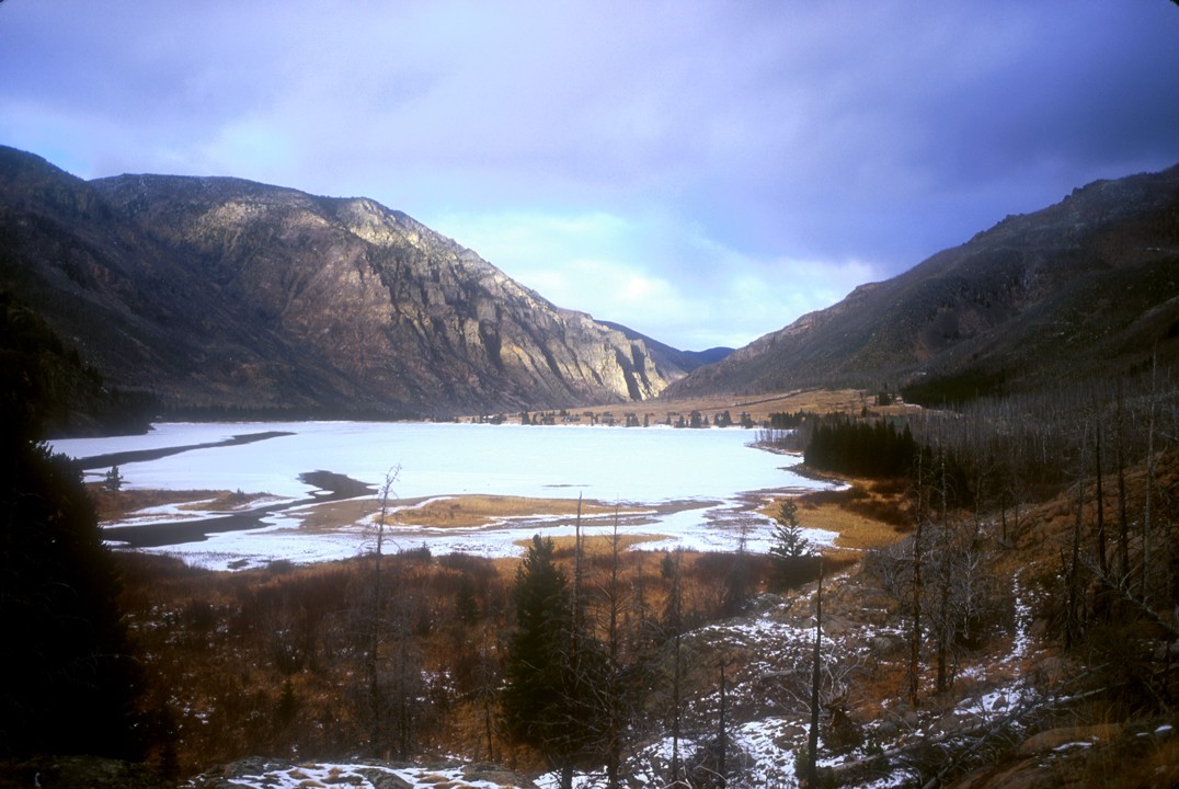
Approach: Follow the East Rosebud road from Roscoe
to the end and park at the hiker parking lot at
East Rosebud Lake. Follow the East Rosebud
- Cooke City Trail around the lake (behind the private cabins) to a rocky
outcropping (called The Hump) where the trail has been blasted into the rock
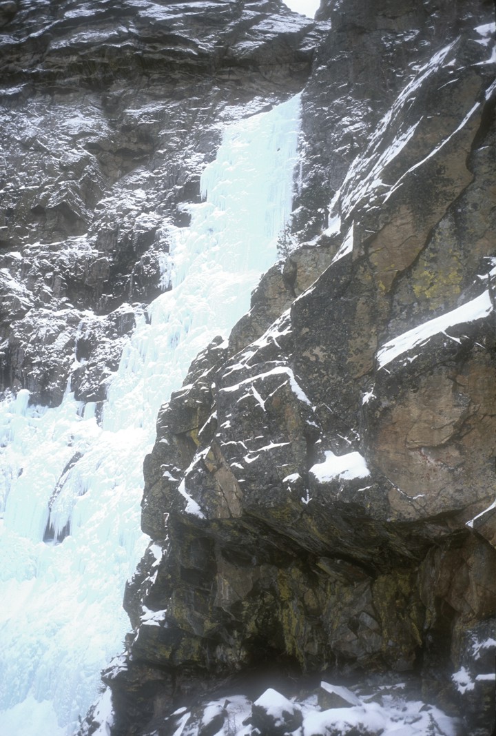
above the river. From here, you can see the top section of the route (the bottom
400' of the route is not visible from the trail) and visually follow the
drainage as it zigzags down through the unlikely cliffbands, then swings way to
the right, crossing the hiking trail about 5 minutes past The Hump. The lower
portion of the drainage is filled with fallen trees, brush, and general
unpleasantness, so we hiked a few minutes past the drainage and ascended a steep
talus slope, gaining about 800' of elevation. From the top of this slope, we
easily contoured into the drainage at a point where the creek is relatively
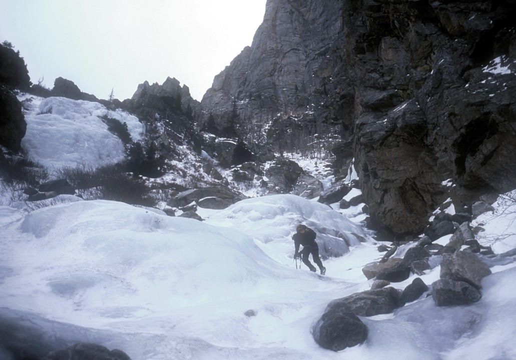
clear of debris and completely frozen. At this point, we donned crampons and
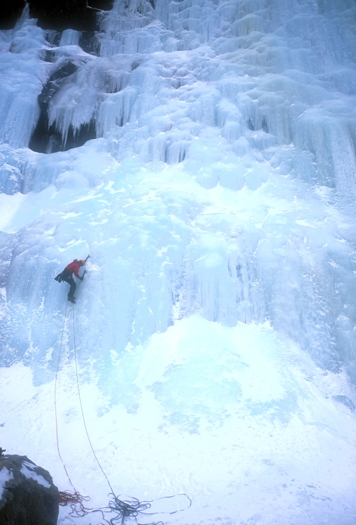
climbed continuous ice (up to WI2) to the
base of the route, 2.5 hours from the
car. The base of the route is open, flat, and quite pleasant.
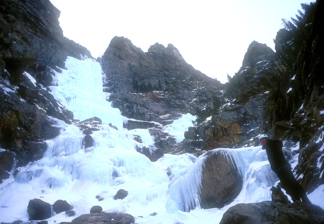
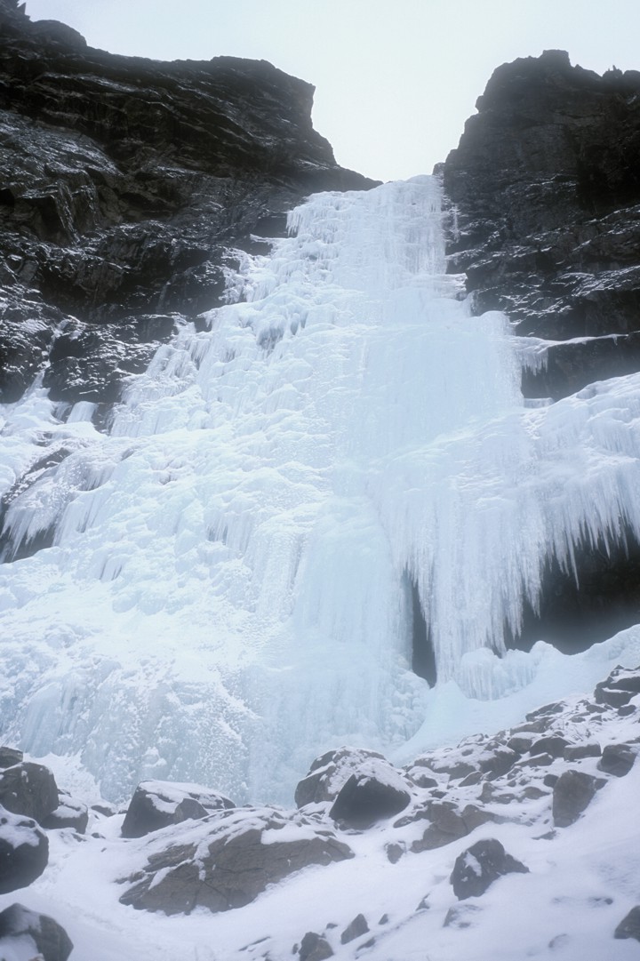
The Climb: We climbed the route in three pitches as follows:
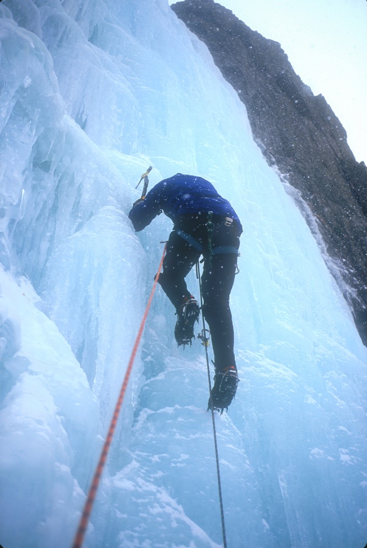
The first pitch took the driest line a rope-stretching 200' to a "ledge", WI4.
There is a rap anchor on a tree ledge just right of the climb at this height.
The second pitch continued directly above the belay to another ledge below a
cave, 200', WI4. There is a piton rap anchor on the rock wall on the right side
of the ledge; looks sketchy.
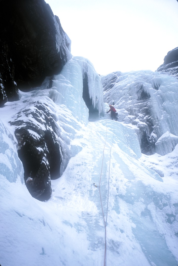
The third pitch climbed just right of the cave on lower angled ice, then up to a
notch in the ridge on the right. The descent begins at this notch. There looks
to be a steeper variation that ascends more vertically on the left side of the
cave.
There is a fourth pitch that ascends low angled ice to another notch in the
ridge. We opted not to climb this pitch.
We took us 2.5 hours to climb the three pitches to the notch.
Descent: Climb through the notch to the right and drop down about 15' on the
other side to a slope with trees. Traverse directly right across this slope for
160' to a large tree with a rap anchor. A 100' rappel places you below an
overhanging rock on top of a steep snow gully. (If the slope looks sketchy, it
may be worthwhile to instead do a double rope rappel from the tree, allowing one
to test the stability of the upper part of the snow gully.) Descend the snow
gully for 230' to a small drop. We did a short 25' rappel here from a tree on
the left. There's an obvious escape rightwards (skiers right) where you can see
the base of the climb; descend rightwards down a sloping ramp back to the base
of the climb. We took 1 hour to descend to this point (but we also stopped for lunch).
From the base of the route, climb down the drainage back to the car. We took 1
hour 50 minutes to return to the car, as there were many sections of WI2 to downclimb. If the gully is full of snow, descent would be trivial, but ascent
could be much slower.